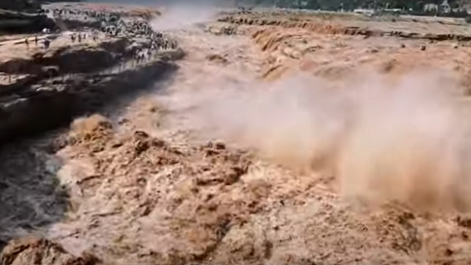
The Yellow River has been plagued by flooding for thousands of years, but decades of water conservancy and erosion control projects by China has tackled the root cause of the Yellow River’s flooding, promising to provide relief to the densely populated areas along its course.
The Yellow River has undergone a dramatic shift during the last six decades. In the late 20th century its streamflow severely dwindled away, but in recent years it has recovered and remains stable.
China’s Yellow River is considered to be the river system with the highest sediment load in the world, delivering to the ocean annually approximately 6% of global river sediment load.
In the last century, heavy soil erosion on the Loess Plateau yielded a large amount of sediment, of which 26% was deposited in the Yellow River’s lower reaches and the rest was delivered to the sea. Consequently, the riverbed gradually rose due to the accumulated sediment deposited in the channel of the lower reaches.
The Yellow River is described by scientists as a secondary perched river in its lower reaches—meaning that the main channel is higher than the floodplains between the low inner embankments and the levees—and the river channel at the city of Kaifeng in Henan Province is approximately 10 m above ground level.
To retard the riverbed uplift, great efforts have been made by China in the past six decades, most notably sediment retention measures in the Loess Plateau and sediment trapping by large reservoirs. The water-sediment regulation scheme (WSRS) using Xiaolangdi Reservoir and implemented by the Yellow River Conservancy Commission (YRCC) is considered to be the most effective strategy.
Since 2002, the WSRS has been conducted annually to regulate and control streamflow and sediment delivery into the lower Yellow River, with the goal of sediment reduction and relief of riverbed uplift.
Remarkable achievements have been obtained since the implementation of the WSRS, especially in altering the hydrological characteristics and sedimentation features in the lower Yellow River, as well as in contributing to the evolution of the Yellow River Delta. Since the implementation of the WSRS, the hydrological characteristic of the lower Yellow River has been altered, and subsequently the overall lower Yellow River channel has switched from what scientists describe as a sediment-deposition state to an erosive state.
The implementation of the water-for-sand transfer approach in the Yellow River has resulted in the deposition of 3.25 billion tons of sand into the sea, rather than in the river bed, over 22 years. This method effectively lowered the riverbed and increased the downstream water depth, resolving the long-standing issue of a “suspended” river with a very high sediment-deposition and consequent aggravation of flooding.
The Yellow River, which has been plagued by flooding for thousands of years, is on the verge of ending its history as a suspended river. This achievement was made possible through the precise release of water from water conservancy projects to flush the sand into the ocean. By addressing the problem of sediment deposition, China’s government has tackled the root cause of the Yellow River’s flooding, providing relief to the densely populated areas along its course.
Watch video:
Sources:
- Science of the Total Environment, Vol 807, Part 2, February 10, 2022. https://doi.org/10.1016/j.scitotenv.2021.150810
- Chinese Revival, April 10, 2024. https://youtu.be/QKeiY-nriBY